

By Marc Turnage
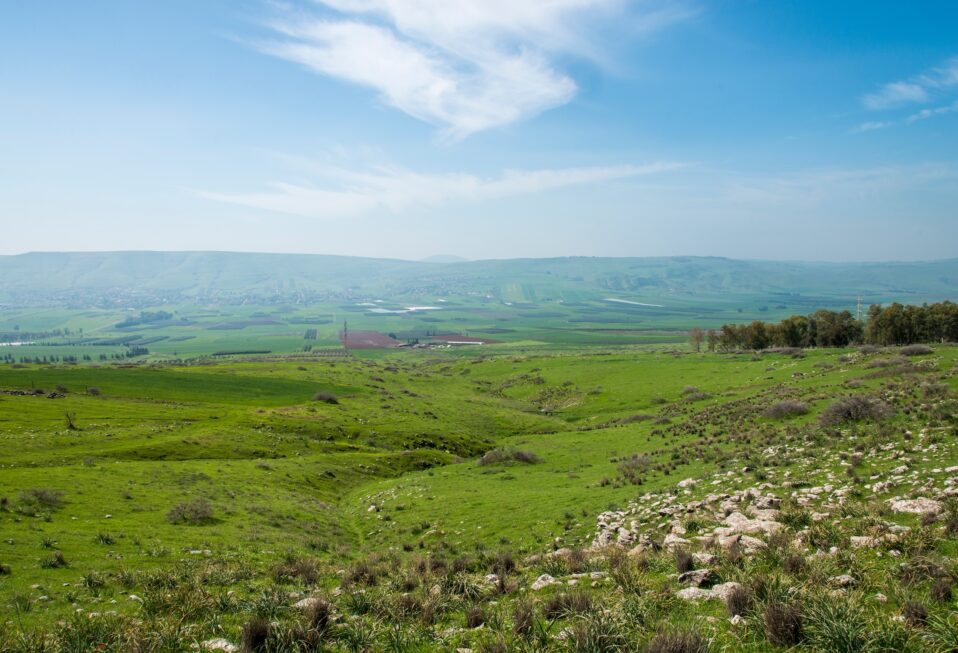
The Jezreel Valley provides an east-west corridor across the Central Hill Country separating the mountains of Samaria from the Lower Galilee. The name of the valley means “God sows,” and it derives its name from an Iron Age site, Jezreel, located on the eastern end of the valley on a rocky spur of the Gilboa mountain range. In the Late Bronze Age (1550-1200 B.C.), the valley seems to have been called “Ginnah,” which also refer to its agricultural fertility.
The shape of the valley is like an arrowhead. The northern mountains of Samaria form its southern boundary. In the west, the Carmel range forms the boundary. The Nazareth ridge forms its northern boundary. In the east, one finds the shaft of the arrowhead, which is the Harrod or Beth-Shean Valley. The shaft of the arrowhead is created by the Hill of Moreh to its north and the Gilboa mountain range to the south. The Harrod Valley ties the Jezreel Valley with the Jordan Valley and the Transjordan. The Kishon River drained the Jezreel Valley towards the west and the Mediterranean Sea.
The valley’s rich alluvial soil and perennial springs make it a great place for agriculture; however, it also tended to flood, in part due to the basalt within the soil of certain parts of the valley.
The Jezreel Valley provided an important crossroads of regional and international travel and commerce. The international coastal highway that connected Egypt with Damascus and Mesopotamia passed through the Jezreel Valley turning east from the coast heading towards Damascus. The Jezreel Valley was separated from the Coastal Plain by the ridge of the Carmel range, which cut across the Coastal Plain and protruded into the Mediterranean Sea.
Three routes passed through the Carmel range and into the Jezreel Valley. The southernmost passed through the Dothan Valley. The central route was the narrowest, and the city of Megiddo guarded its entry into the Jezreel Valley. The northern route passed by the ancient site of Yokeneam. The Jezreel Valley also connected with the north-south route through the Jordan Valley, as well as the routes in the Transjordan.
In fact, the Jezreel Valley served to connect the international coastal highway with the King’s Highway that ran north-south through the Transjordanian highlands. These two important routes met in Damascus. Also, the main north-south route through the Central Hill Country terminated at the Jezreel Valley.
The Bible recounts three battles taking place within the Jezreel Valley. Deborah and Barak fought the Canaanite forces of Jabin, king of Hazor, and his general Sisera (Judges 4-5). Gideon fought the Midianites on the Hill of Moreh (Judges 6-7). The third battle was Saul’s fight against the Philistines, in which Saul and his sons perished (1 Samuel 29-31). Numerous events in the Bible happened in cities and settlements around the Jezreel Valley attesting to its importance and strategic significance.
Marc Turnage is President/CEO of Biblical Expeditions. He is an authority on ancient Judaism and Christian origins. He has published widely for both academic and popular audiences. His most recent book, Windows into the Bible, was named by Outreach Magazine as one of its top 100 Christian living resources. Marc is a widely sought-after speaker and a gifted teacher. He has been guiding groups to the lands of the Bible—Israel, Jordan, Egypt, Turkey, Greece, and Italy—for over twenty years.
Website: WITBUniversity.com
Facebook: @witbuniversity
Podcast: Windows into the Bible Podcast

Post a comment